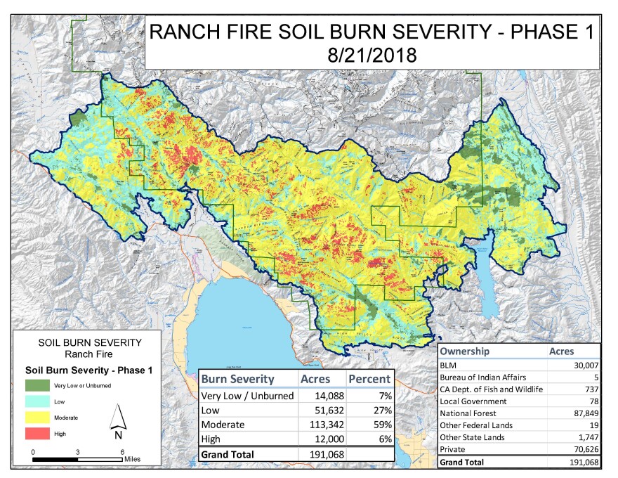
Aug 31, 2018 -- The US Forest Service has sent a Burn Area Emergency Response, or BAER team, into the southern portion of the Ranch Fire to assess the damage to roads and soil. Thus far, only the bottom 191,000 acres have been checked out by a team that includes geologists and hydrologists. The USGS has also contributed work on the probability of debris flow.
At a community meeting in Nice on August 30, US Forest Service representatives shared their findings and talked about what's next. While the probability of erosion is not as severe as might have been expected for a fire of this magnitude, the USGS does expect debris flow during a typical early winter two-day storm.
The BAER team recommends engineering changes to some forest roads, and weed treatments to discourage weeds that often grow up around dozer lines. We'll hear from Jess Clark, an assistant program manager with the US Forest Service, and Frank Aebly, the district ranger for Upper Lake and Covelo.
Clark goes into detail about the treatments, the dangers in the portions of the forest that are closed, and the encouraging signs of vegetation he's seen while assessing the area. He also talks about changes to permits for landowners who need to go through forest lands to get to their property. As of yesterday, the permit extends to people designated by the landowner, with proper documentation.
Aebly discusses forest management, including prescribed burns, and forest research projects that were destroyed by the fire. I'm including lightly edited versions of my interviews with both of them, as well as the short broadcast about the meeting.


